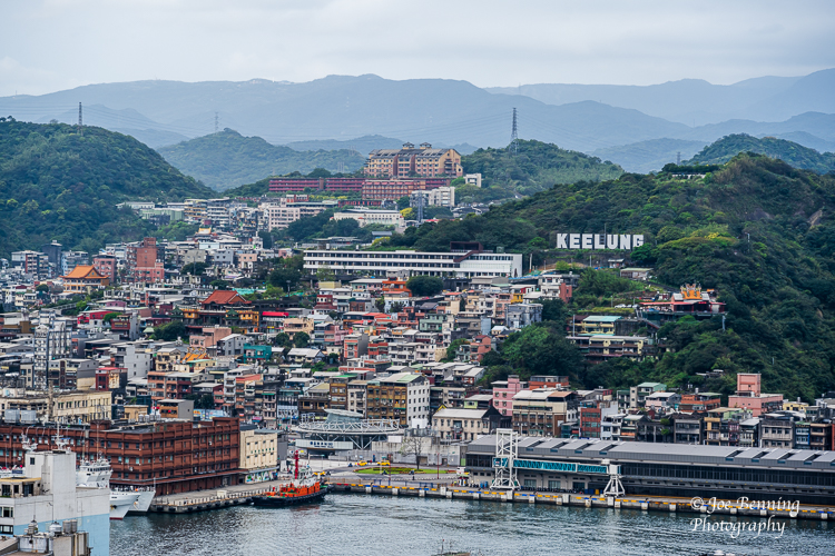
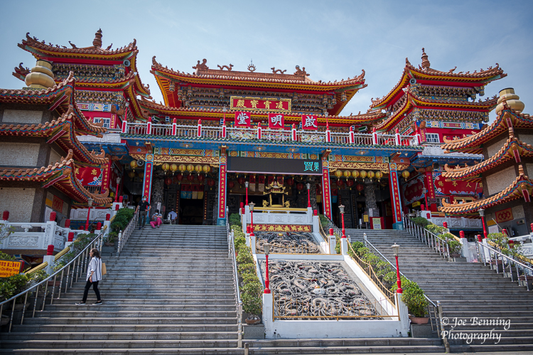
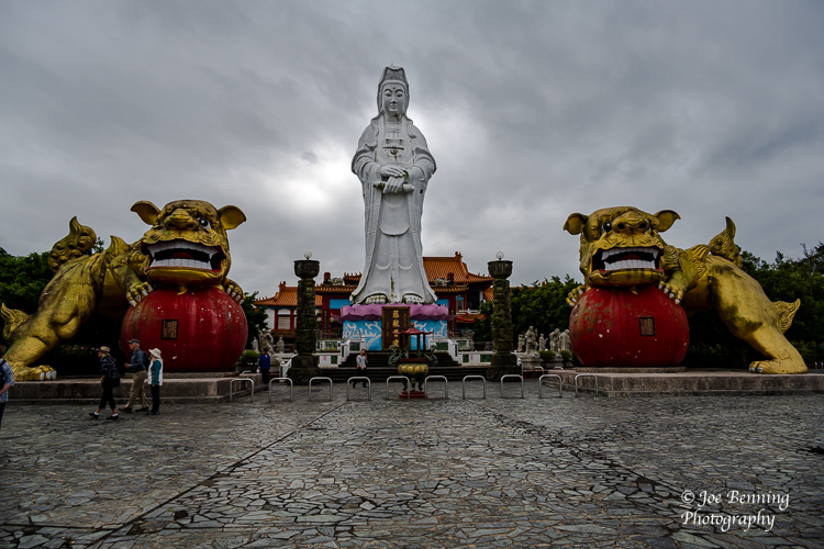
We sailed into the port city of Keelung Taiwan on March 14 bypassing a scheduled port-of-call a day earlier because of bad weather. After Keelung we sailed into the port city of Kaohsiung. Keelung, the second largest port in Taiwan, has a population of about 360,000; Kaohsiung with a population of 2.77 million is much larger and more modern.
The captain of the ship has told us that we are sailing in Chinese waters by permission. That might explain why our internet connection has once again become an on-again, off-again proposition. The Chinese government of the Peoples Republic of China (PRC), an authoritarian surveillance state, is not exactly cooperative when it comes to providing access to information sources outside of its control.
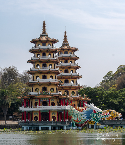
Be that as it may, Taiwan is a land of Temples. Lots of them. In Keelung we visited a giant Buddha and temple; in Kaohsiung we stopped in at the iconic Chi Ming Tang Temple; a Confucian temple and numerous Pavilions at Lotus Pond.
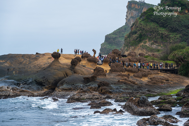
It wasn’t all temples all the time though. For instance, we visited Yehliu Geopark near New Taipei City and saw some amazing rock formations created over the centuries by the ocean washing over the hoodoo stones there. Pagodas and Pavilions surrounded Lotus Pond—a man-made pond that we visited across the street from The Chi Ming Temple.
All in all it was pretty interesting. That said, the architecture was pretty uneven. Some places were new and modern especially in Kaohsiung. In others, like the port city of Keelung, the architecture was unappealing, to say the least.
And now it’s off to Vietnam. First stop is scheduled for March 18 at Halong Bay.
Some photos are below.
JFB
Keelung PortChi Ming Tang TempleGiant BuddhaPavillion by Lotus PondTourists on the Rocks
We are sailing toward Taiwan looking to dock in our second scheduled Taiwanese port because we missed the first one (Hualian) due to bad weather. Really bad. We sailed through the night through waves as high as 14 feet, so we got knocked about quite a bit. We’ll see what tomorrow brings.
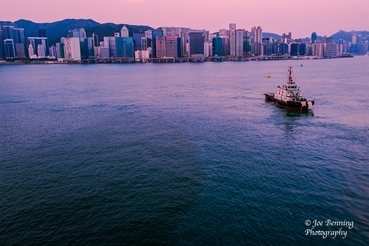
Approaching Hong Kong
We docked in Hong Kong this past Monday morning to spend about 8 or 9 hours touring around the city. Cranes are visible everywhere you look. No matter how you slice it, there is a massive amount of construction going on. But the continuing prosperity of Hong Kong depends on the relationship between Hong Kong and the Chinese mainland.
On June 20, 2020 the Chinese government bypassed the legislature in Hong Kong and imposed a national security law contravening its Treaty with the UK. The move significantly eroded Hong Kong citizens’ rights. Since then Beijing has cracked down on dissent and jailed opponents of the new regime. Whether Hong Kong can remain a banking and finance powerhouse in the face of this remains to be seen.
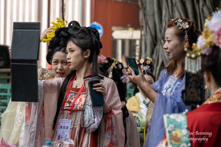
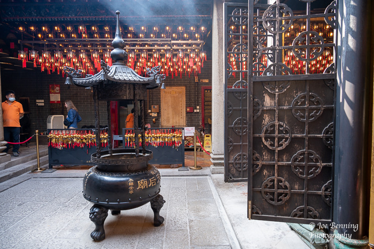
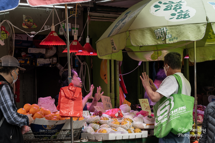
Be that as it may, we were very busy in Hong Kong. Our visit included trips to the famous Tin Hau Temple dedicated to the Taoist goddess of the sea. While there, in the park outside, we saw You Tube videos being filmed featuring (mostly) young women dressed in traditional outfits representing various Chinese dynasties. Then we made our way to Hong Kong wet and dry markets. (These were not at all like the wet markets in China that sell live animals.)
Chinese Women in Traditional OutfitsInside the Tin Hat Temple
After that we boarded a double decker tram and visited trading districts that maintained markets in Chinese herbal medicines, traditional wedding dresses, incense and all sorts of traditional Chinese products. Then we had Tea and snacks at a local cafe.
Bargaining in the Market
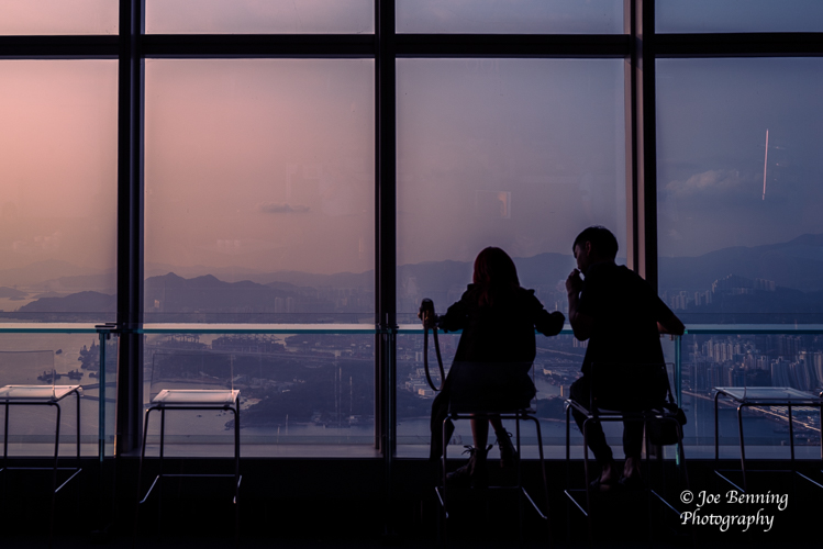
We weren’t quite finished though. We followed up with a tour of Hong Kong at night which featured spectacular views of the city from the 100th floor of Hong Kong’s tallest building. Finally we headed off for cocktails and canapé’s at the Kerry Hotel while overlooking Victoria Harbor.
Photo taken in the Sky 100 Observation Deck
And before I forget. Our guide, who is Chinese through and through, insisted (jokingly) that he is really Irish and that his name is Patrick, but his friends call him Paddy. The guy was a riot.
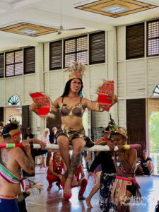
We sailed into the Philippines on March 7, 2023 and then spent a few days touring around the country, traveling to 2 islands in the archipelago. The first was Palawan where among other things we visited a Philippine Penal Farm where minimum security prisoners put on a show for us. Kind of bizarre. Apparently it’s kind of an experimental facility where inmates are not behind bars, live with their families and serve minimal time.
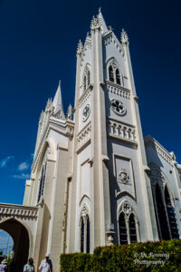
More conventionally we also visited both a WWII memorial, and the Immaculate Conception Church built in the early 1600s, making it one of the oldest churches in the Philippines.
Puerto Princessa, the Philippines–March 7, 2023. A wide angle shot looking up the exterior of the Immaculate Conception Cathedral.
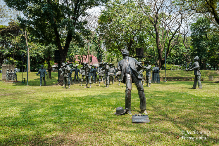
A couple of days later we were in Manilla on the island of Luzon where we visited Fort Santiago, San Agustin Church and Rizal Park. It is here at Rizal Park where Filipinos commemorate the heroism of Jose Rizal a leader of the drive for independence from Spain. The Spanish colonial authorities executed him by firing squad on Dec 30, 1896, at the age of 30.
Photo of a statue of Jose Rizal before a Spanish firing squad.
The Spanish colonial authorities refused Rizal’s request to face the firing squad and so they shot him in the back because they regarded him as a traitor. Nevertheless, the Philippines gained its independence from Spain 2 years later in 1898. Filipinos regard Jose Rizal as a national hero and have a memorial in the park (named after him) tracing the day of his execution.
Some more photos are below.
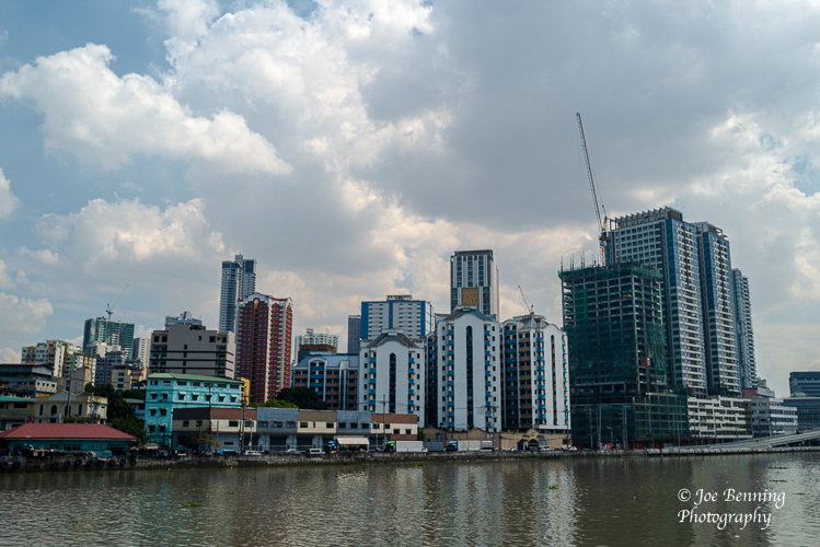
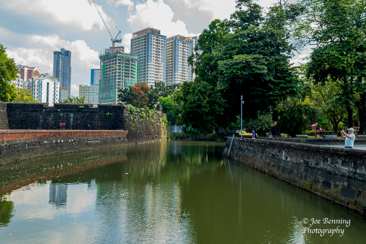
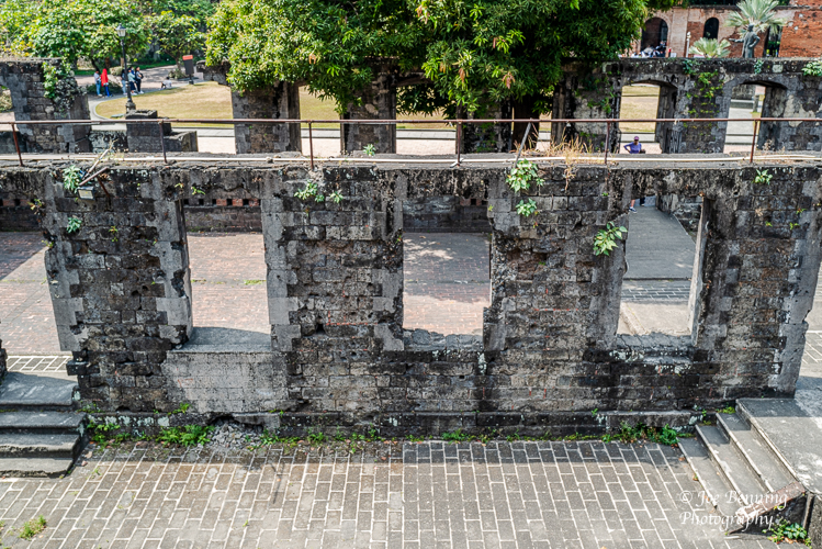
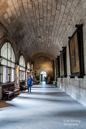
A wide angle shot of the Manilla skylineManila, Philippines–March 9, 2023. A wide angle photo that shows a lake in historic Fort Santiago with the city on the background.A photo taken inside the walls of the historic Fort SantiagoManilla, Philippines–March 9, 2023. A vertical shot taken in a corridor of San Agustin Church.
We sailed into what is officially known as Brunei Darussalam on March 5. Brunei is one of the smallest and statistically richest countries in the world. It has only about 450,000 residents with an estimated per capita GDP of about $75,000 for 2022. For rough comparison purposes, U.S. per capita GDP for 2022 was about $77,000, which is about 5 times the world average.
But Brunei’s numbers have to be taken with a large grain of salt. One of the obvious reasons for that very high per capita GDP is oil and gas, the prices of which rose considerably over the last few years. Another is that Brunei is an absolute monarchy. All the revenues from oil and gas flow through the Sultan of Brunei, making him one of the richest men in the world. But that doesn’t necessarily make Brunei a wealthy society.
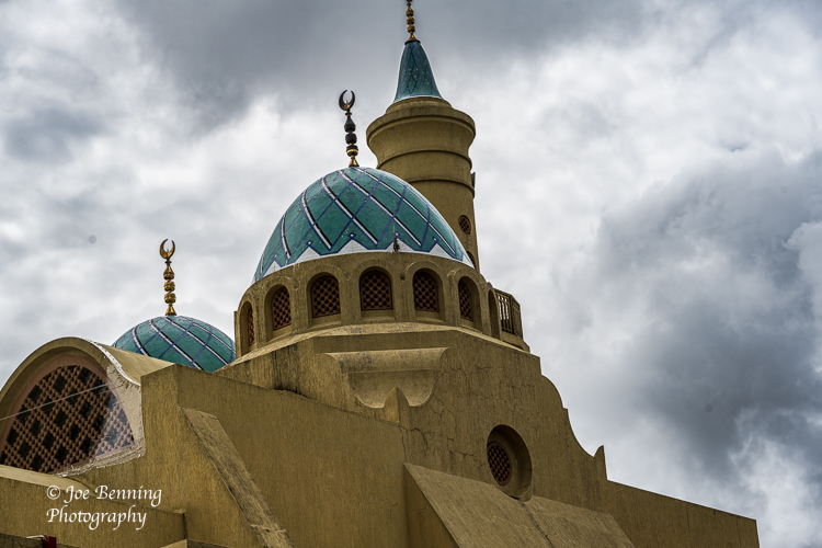
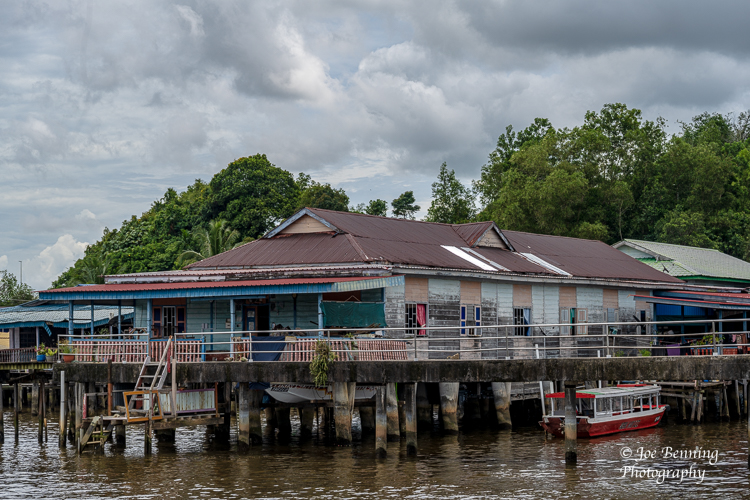
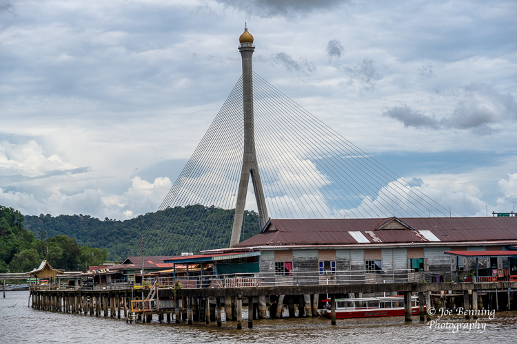
We did see impressive architecture, especially of Mosques and huge government buildings—but we also visited the Kampong Ayer Water Village—and believe me, you wouldn’t want to live there.
Photo of a Mosque taken in BruneiPhoto of a Water Village outside Bandar Seria Bagawan, Brunie’s capital city
The governance of Brunei is a strange combination of the traditional British common law and a form of sharia law. Our guide pointed out that they have moderated sharia law. For instance they don’t cut off thieves’ hands anymore; a less-than-convincing example of moderation. Another assertion was that sharia law was supposed to protect women in Brunei. I seriously doubt that anyone on the tour bought that.
We visited what was essentially the Royal Museum (an ode to the Sultan) where we had to proceed without shoes so as not to ruin the carpets, or so we were told. There we got to view the Sultan’s chariots and a history of the Sultan’s family. The guide also noted that he was happy to answer any of our questions, but to please hold off until we were in the bus so he wasn’t overheard, just in case he said something the authorities were likely to frown on.
So there you have it. An absolute monarchy that is a one man show, closely tied to the price of fossil fuels, making the country vulnerable to a downturn in markets for oil and gas. And of course the government provides lots of free services. Except that the price of “free” services is a denial of individual liberty. That is worth thinking about.
JFB
Photo of Jame-Asr-Hasannil-Bolkiah Mosque taken in BruneiPhoto of Kampong Ayer Water Village with bridge in background
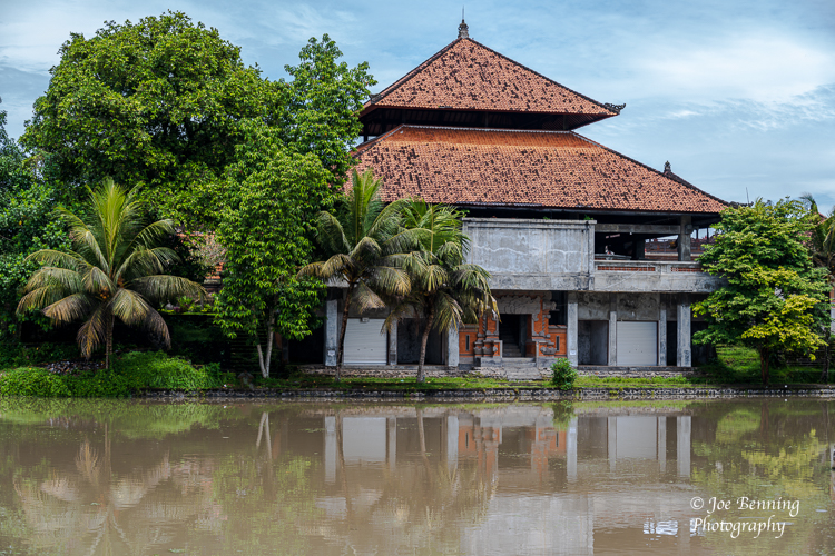
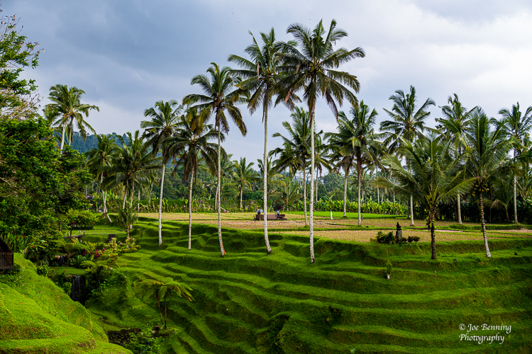
We just spent several days in Indonesia on Bali and Java islands. On Bali Island, among other things we visited Denpasar, the capital city of the region. We stopped into Tohpati Village a section of the city; had a coffee break by a rice paddy, and visited the Royal Temple.
We should mention that there are coffee shops everywhere, presumably because like just about every other country we have visited, they have the “best coffee in the world”. Actually, come to think of it, the coffee is very good.
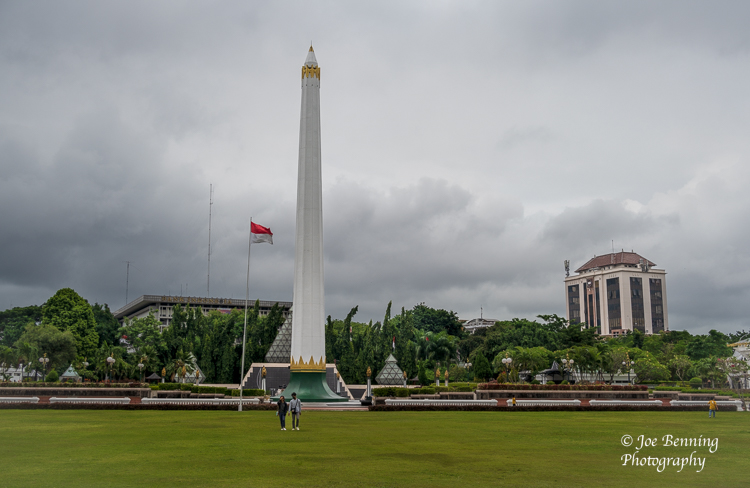
On Java we visited Surabaya, the capital city of East Java. We went to a small Village, and spent some time at a park that celebrates Indonesian independence. We also spent some time at the Malapahit Hotel, a colonial era luxury establishment designed by the architect R.A.J. Sidwell who designed Raffles in Singapore. And guess what? It looks just like Raffles.
It is one thing to read about the many islands, tribes, ethnicities and religions in Indonesia, and quite another thing to see this in action. The cities are crowded, colorful and full of sights, sounds and smells (many from local spices and foods).
In a way, it is exotic and interesting and can easily become sensory overload. Everywhere people smile when we engage, thank us for visiting and bow slightly as they say thank you.
Outside of the cities, there are lush tropical forests and pristine beaches. It is a land of many contrasts.
We have had a wide range of experiences during our days here, visiting old cultural villages and historical sites, stopping along the way for tea, coffee and delicious snacks, and generally learning about the history and culture of Indonesia. We have heard and seen several dances and music performances (from traditional chants to pop rock songs, all of which were very good), as well as calls to prayer. The country is almost all Muslim, with the island of Bali being the exception where some 90% of the population is Hindu.
All in all, an incredible experience. And now we are sailing for Brunei where we are scheduled to dock on March 5. A few photos from our time in Indonesia are posted below.
MAM & JFB
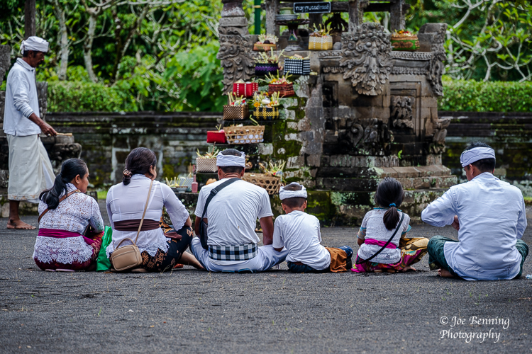
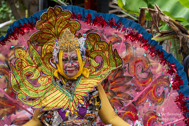
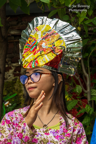
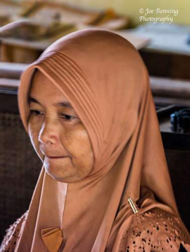
A photo taken on the grounds of the Royal Temple (the Tamun Ayun Temple)A Family Prays in the Inner SanctumPhoto of coconute trees and a Rice Paddy in Bali Indonesia.Surabaya, Indonesia–March 2, 2023. A woman poses for a photo in SurabayaSurabaya, Indonesia–Mar 2, 2023. A young dancer in Kampoeng Lawas Mespati VillageSurabaya, Indonesia–March 2, 2023. A monument designed to celebrate Indonesian IndependenceWoman Working in Batik Factory
Darwin, with a population of about 150,000, is the capital city of the Northern Territory in Australia. The city houses the majority of the residents of the Territory—a territory that is Australia’s version of the Wild West. It has a reputation as a hard drinking party town, although that has toned down a bit over the years.
Darwin is the smallest and most northerly of Australia’s capital cities. It is also younger than average—33 v 37 for the rest of Australia—due in part to the large number of military personnel stationed there because of the area’s strategic importance.
As a result of its proximity to South East Asia, the city is a key link to Indonesia and East Timor. The climate is tropical. There are two seasons—the wet season and the dry season. We are in the wet season at the moment. The two main industries of Darwin are mining and tourism.
About 38% of the population was born overseas. About 70% of the population identifies their ancestors as either English or Australian. Just under 9% of the population is indigenous, which essentially means aboriginal. 58% of the population speaks English at home.
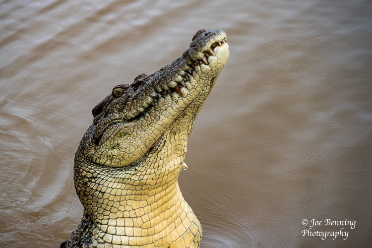
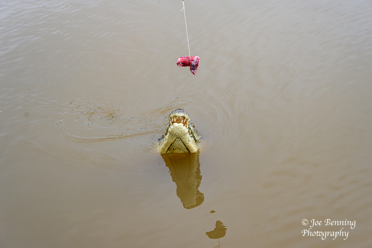
While berthed at Darwin, we took a tour boat on the Adelaide River, on the lookout for crocodiles. The Adelaide River is home to a large population of these creatures. It wasn’t hard to find them since the boat crew lured them with buffalo meat. Crocodiles have hardly evolved over thousands of years; they still look like creatures out of a Jurassic Park movie. Crocodiles are not exactly Benjamin Spock trained parents. They mate; the female lays her eggs and takes off, looking for a new boyfriend. The male stays with the offspring for about 6 to 12 months and then heads off. The young crocs are then on their own. Many of the young are eaten by other creatures, sometimes by their siblings or parents.
Crocodiles are very aggressive; the males are particularly territorial. The larger crocs (we saw one that was 16 feet long) guard their territory until the younger ones are large and agile enough to attack them. Which they then proceed to do. Apparently none, or at least very few, have BFFs.
The crocs that we saw were fed buffalo meat by the boat’s crew so the passengers could get a look at them in action. It was a good reminder of why it is important to keep arms and legs inside the boat. A few photos from the boat trip are below.
JFB
A salt water crocodile sticks his head up from the Adelaide River in search of food.Photo of Kyte Birds of prey on the banks of the Adelaide River in the Northern TerritoryA crocodile comes up from the depths of the Adelaide River in search of food.
Finally we arrived in Australia. Cairns to be exact. We were supposed to go on an overland trip to the Outback and Ayers Rock, but that didn’t pan put so we booked some tours for the ports we would be visiting, starting with Cairns.
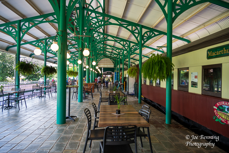
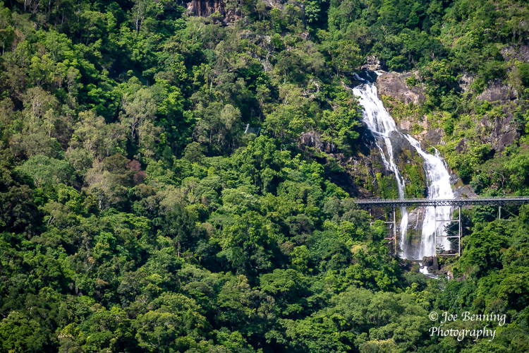
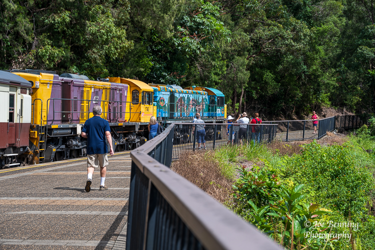
We decided to go on a tour of the Kuranda Rainforest. We started by taking a train ride through the rainforest in the approximately 100 year old restored train line now known as the tourist friendly Kuranda Scenic Railway. We were treated to spectacular views of the rain forest with its waterfalls, deep ravines and mountains. Occasionally we could see out to the coast from the mountains.
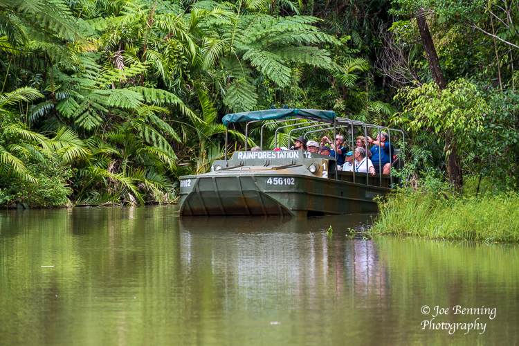
Next we went for a ride in amphibious vehicles which were originally designed for use in WWII. These vehicles, now manufactured fro civilian use, are known as “Army Ducks”. The Army Ducks were (and are) made exclusively by women. We drove—actually we were driven—through a portion of the rain forest, which included a brief drive in a shallow lake. We successfully avoided eating the extremely poisonous berries and other plants that inhabit the rain forest; we also avoided the venomous snakes and Cassowaries who live there.
Cassowaries are about the size of ostriches, have razor sharp toe nails and are quite capable of slicing up and killing adversaries with their feet. Best viewed in zoos or from a distance.
After that adventure we visited a Rainforest Preservation Zoo with the obligatory kangaroos, some crocodiles, a Cassowary and of course, a Tasmanian Devil. After that it was back to the ship.
The next scheduled stop was Cooktown, but that was cancelled due to the weather. Apparently it would have been too dangerous to get the tender ships ashore. So we are off to Darwin, named after Charles Darwin, where we should arrive in a few days.
In the meantime, a few photos from out rainforest travels are below.
JFB
Cairns, Australia–Feb 20, 2023. Wide angle photo of the Freshwater train station where we caught the Kuranda Express.Photo of a rain forest waterfall taken in Barron Gorge National Park in Northern AustraliaBarron Gorge National Park, Australia — February 20, 2023. Photo of tourists riding in an Army Duck amphibious vehicle.Barron Gorge National Park, Australia — February 20, 2023. A photo of the 100 year old Kuranda Scenic Railway Train in Barron Gorge National Park.
When we arrived at Papua New Guinea (PNG) the morning of February 18, 2023 we went (briefly) through the town of Alotau. The town has a population of about 30,000 (according to our tour guide) and it seemed like everybody was in the town center, largely because it was Saturday and time to do the weekly shopping etc.
Population estimates have to be taken with a very large grain of salt. The last official census estimate, taken in 2011, put the population of PNG at a little over 7 million. By 2020 population was estimated to be around 9 million. But…as recently as December of 2022 a new estimate put the population at over 17 million—about double to estimate from 2 years ago. It’s probably safe to say that they have no idea what the actual population count really is.
PNG was largely ignored by European colonialists in the 17th and 18th centuries. It was WWII that prompted the Americans and Australians to build military bases on PNG to fight against Imperial Japan. Up until that point PNG was isolated from the rest of the world for over a hundred years. Most of the natives of Papua New Guinea had probably never seen a white man, much less a car or the airplanes that were all-of-a-sudden swooping down on them.
Papua New Guinea is often described as linguistically diverse. That’s an understatement if there ever was one. There are 839 known languages spoken here. Language diversity probably stems from the lack of urbanization. The vast majority of the population—about 85%–lives in rural areas. And by rural I mean traditional village communities.
PNG is officially listed by the IMF as a developing country, meaning it’s poor. Very poor. Something like 85% of the population earns its livelihood from Agriculture, which essentially means subsistence farming and some cash crops. Agriculture accounts for 30% of GDP. To put this in context, Papua New Guinea per capita GDP in 2019 was about $3,800; US per capita GDP for 2019 was about $65,000, about 17 times higher.
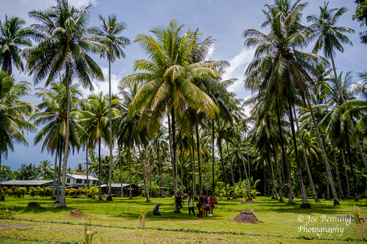
Anyway, we visited a traditional village community in the jungle. A prominent fixture in the village was a Catholic missionary school. (About 95% of the population consider themselves to be Christian).
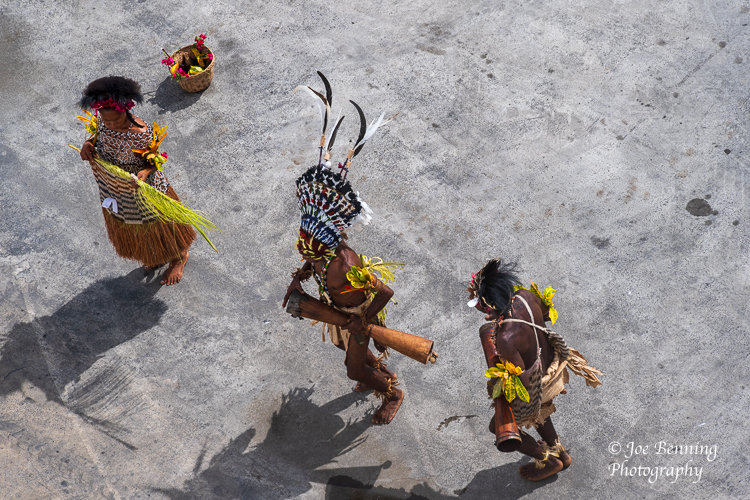
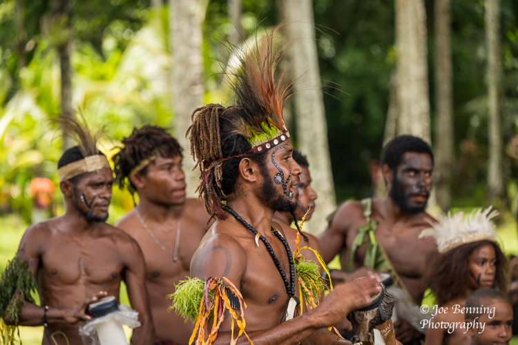
We enjoyed watching the villagers, mostly young people, perform some traditional dances while wearing native dress. They also displayed various wares for sale. Some photos from our visit are below.
JFB
Alotao, Papua New Guinea–Frbruary 18, 2023. Telephoto image of a greeting party in native dress of the dock in Alotau, Papua New GuineaA wide angle photo of a village on Papua New Guinea near Alotau.A wide angle photo taken of a village school in Papua New GuineaAlotao, Papua New Guinea–Frbruary 18, 2023. Telephoto image of young warriors and thier leader in a village outside Alotau, Papua New Guinea
We have just spent 2 days in the country of Vanuatu, which is comprised of 13 principal islands and many smaller ones. It is approximately 500 miles west of Fiji and 1100 miles east of Australia. Vanuatu’s was subjected to colonial rule by England and by France, after which England and France set up a joint administration.
Vanuatu achieved independence in 1980. Its history is one of Vanuatu many local tribes (separated by mountains and forests), as well as explorers and conquerors from Europe, Christian missionaries, and eventual democracy.
Vanuatu is part of Melanasia; the island region of dark-skinned peoples, which together with Micronesia (the many small islands north of Melanesia) and Polynesia (the island groups from the Hawaiian Islands to Easter Island, off the coast of Chile) comprise what is often referred to as the Pacific Islands. The Pacific Islands are neighbored by Australia, Indonesia, Philippines, and the islands and archipelagos that project seaward from Japan.
These islands constitute the “ring of fire” that sits beneath the Pacific Ocean where earthquakes are relatively common. We experienced one the other day, about 25 miles away, measuring 5.4 on the Richter scale – the ship shuddered for several seconds.
Due to the large number of indigenous tribes, there are over 100 local languages and dialects spoken in Vanuatu, as well as English and French and “pidgin” English. Large billboards in the city of Port Vila (the capital city) promote soft drinks as the “numbawan” favorite (number one).
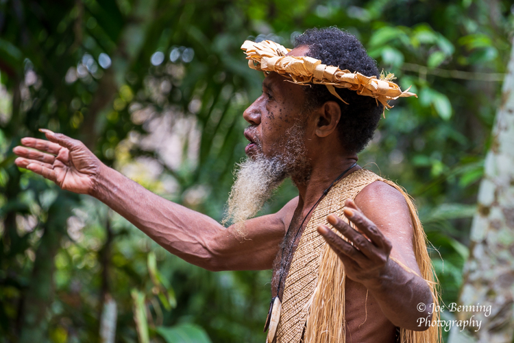
One of the most interesting visits for us in Vanuatu was a visit to a cultural village a few miles outside of the capital city. The Ekasup tribe of 300 people still live in this village, and allow tours by visitors. When our small group arrived at the village (by van), we were led to the Chief of the Village by a young man blowing a conch horn. The Chief welcomed us and demonstrated the use of palm fronds to designate an area as “tabu” until other palm fronds were used to signal that a peaceful entry was acceptable.
The Chief provided a fascinating presentation of life in the village, how land passes from father to son, the role of women, crops and cooking, clothing (woven from plants), hunting for pigs, chickens and fish (done largely with traps), medicine and medicinal plants, music, dance, burial practices, cannibalism (no longer practiced but previously practiced when hunger threatened the lives of the tribe members), and dealing with cyclones (which includes seeking shelter in the enormous space within the roots of a giant Banyon tree).
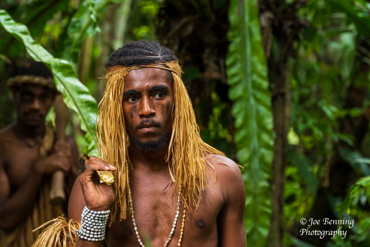
Young men and women must qualify to be married in the Ekasup tribe; the women must know how to weave clothing, prepare food and care for children; the men must know how to fish and hunt for food. When these skills have been mastered (and currently, after the participants reach age 18), there are gatherings in the village so that parents can ascertain the wealth of future sons-in-law (feathers of various colors and sizes are worn to indicate how many pigs the young men own), and dowry negotiations take place, often framed to achieve marriages to increase family land holdings.
Thankfully, wedding bands are used now, instead of the former method for identifying that a woman in this tribe was married. In the old days, one of her front teeth was knocked out to show that she was “taken”. In cases where the parents’ choice of a mate did not meet with the approval of the bride or groom, a love potion was administered with, it is alleged, a quick positive result.
It was fascinating to see this small village just a few miles from the center of a large modern city, and to learn that there are many other tribal villages throughout Vanuatu. The governance of Vanuatu is based on elections to a national Parliament, and the constitution provides as well for a national council of chiefs, to advise the government on matter of custom and tradition.
For more information about Vanuatu and its current state, including education systems, commercial and cultural matters, lots of information is available on the Britannica website.
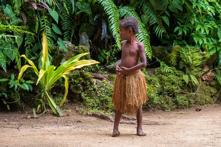
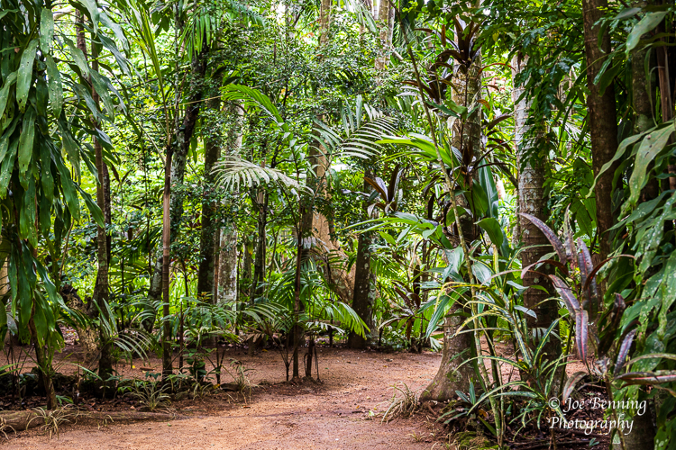
Some photos of the village, the tribal chief and others are below.
JB and MA
Ekasup Village, Vanuatu–Feb 15, 2023. Portrait of thre Village Chief in Ekasup Village, Vanuatu.Ekasup Village, Vanuatu–Feb 15, 2023. Portrait of a Warrior in Ekasup Village, Vanuatu.Ekasup Village, Vanuatu–Feb 15, 2023. Portrait of young giirl in Ekasup Village, Vanuatu.Ekasup Village, Vanuatu–Feb 15, 2023. Photo of a welcome dance in Ekasup Village, Vanuatu.Photo of the jungle environment where Ekasup Village is located.
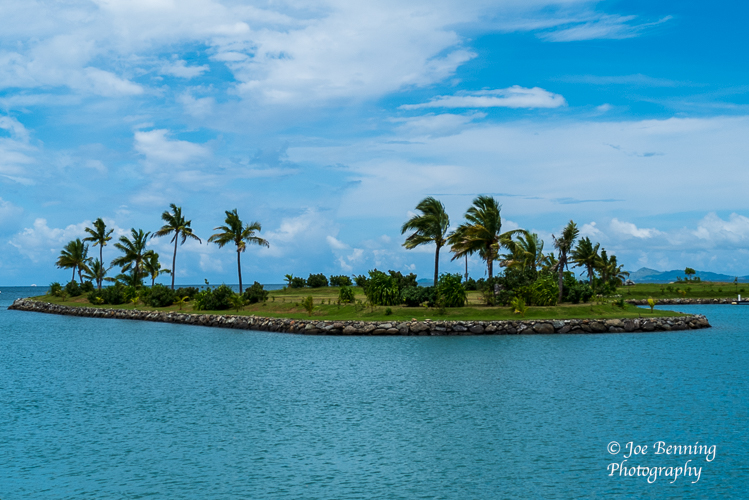
After crossing the International Date Line on February 9, we stopped in Fiji, officially known as the Republic of Fiji. It is an island country in Melanesia and a part of Oceana in the South Pacific. Fiji is an archipelago consisting of over 300 islands, with slightly more than 100 of them inhabited.
Democracy in Fiji is kind of fragile. In December of 2022 the military stepped in after election results were contested and now Fiji has a coalition government. Coups are not all that unusual in Fiji — there have been several in recent years. This most recent one seems to have elicited a shoulder shrug from the citizens.
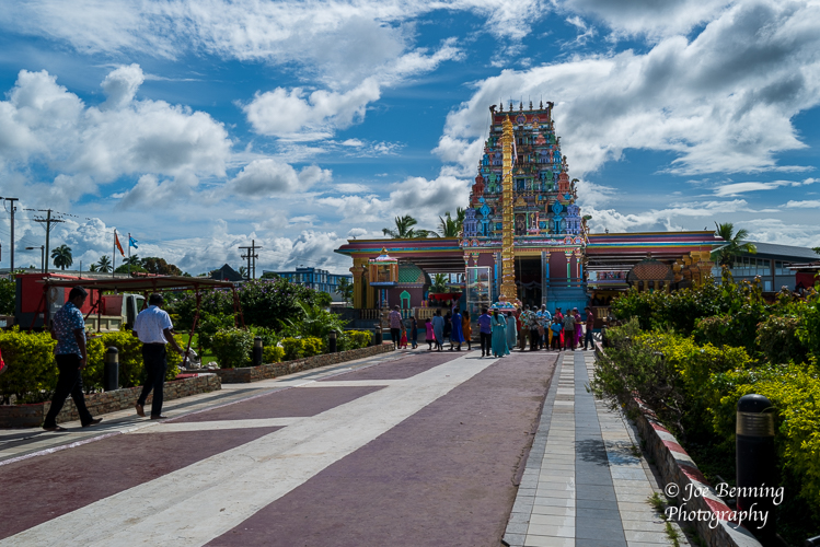
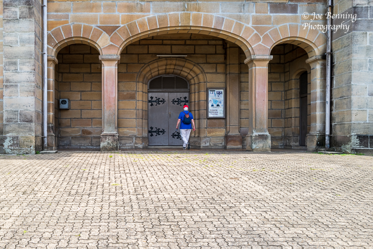
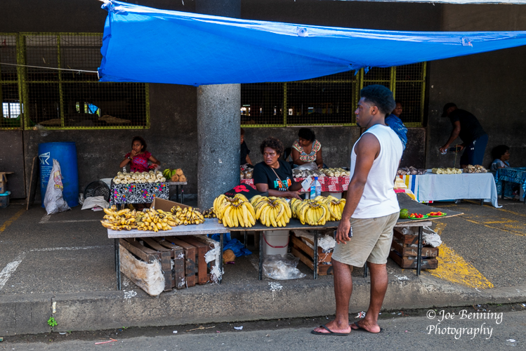
Anyway, we visited 2 cities on the island of Fiji: Lautoka and Suva. Lautoka is famous for its orchid gardens established and maintained by Raymond Burr, otherwise known as Perry Mason. While there we saw a brightly colored Hindu Temple on the last day of a days long celebration. In Suva, the capital city of Fiji, we attempted to go to Mass in the Sacred Heart Cathedral. No luck—it was closed. We did see an open air market though.
In truth, other than the orchid gardens and beautiful beaches that are away from the cities, there is not an awful lot to see. It’s really a place to get away from it all.
Some photos from our visit are below.
Joe
Off the coast of FijiHindu Temple in FijiEntrance to Sacred Heart CathedralSection of an Open Air Market in Suva. Fiji
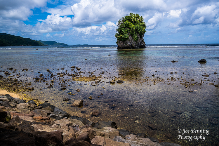
Located on the island of Tutuila, Pago Pago is the capital city of American Samoa. Officially known as Territory of American Samoa, it is an unincorporated territory of the United States. And as we just recently discovered, Pago Pago is not pronounced Pay-Go Pay-Go. Rather, it is pronounced Pango Pango, so that it rhymes with Tango Tango.
It is located in the south central pacific, about 1,600 miles northeast of New Zealand and 2,200 miles southwest of Hawaii. The climate is tropical. Temperatures range from 60 to 90 degrees, and the island of Tutuila gets a lot of rain—about 200 inches annually. Consequently lush vegetation dominates the island.
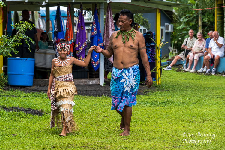
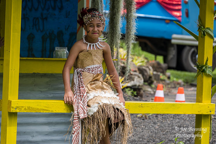
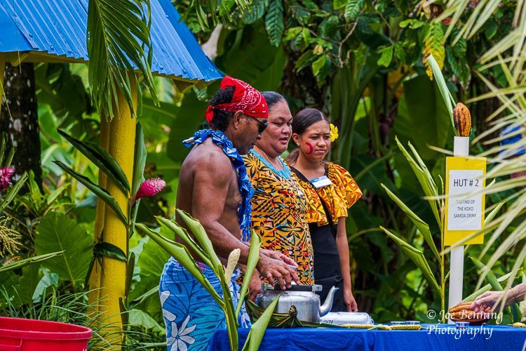
We took a tour that included a look around the Western side of the island and a visit to a village called Talofa where we were treated to a demonstration of local customs including food, cooking styles and native folk dances. It was all very interesting, but no, we didn’t try the food. Some photos from the visit are included below.
JFB
American Samoa — February 7, 2023. Photo of a young Samoan princess being escorted tto center stage as tourists look on in the background.Americsan Samoa–Feb 2, 2023. A portrait photo of a young American Samoan girl in native dress.American Samoa–Feb 7. 2023. A zoom lens photo of 3 natives of Pago Pago at a tasting hut for locally prepared foods.Wide angle photo of a rock formation (called a flower pot by the locals) off the cost of Pago Pago.Photo of a house built by a winding road on the side of a mountain
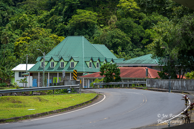
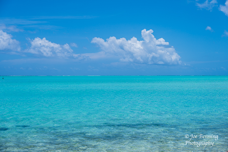
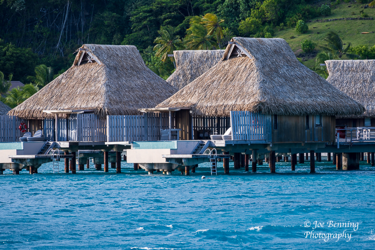
We arrived at Bora Bora on Friday February 3rd for a 2 day port-of-call. It is an island of legend, known for the lagoon that circles the island with its beautiful turquoise waters teeming with undersea life makes the waters especially good for snorkeling. And there are the famous thatched roof huts built over those waters. These days many are owned by upscale hotel chains.
Captain James T Cook was the first European to discover the island in 1769. The British were not particularly interested in Bora Bora, so the French colonized it. Bora Bora became a key island in the eventual struggle for independence from France. It became a French protectorate in 1888, about 40 years after the French annexed Tahiti. Now it is mostly a tourist destination. Although the tourist trade was particularly hard hit by the pandemic, it seems to have recovered nicely.
Some photos of our recent visit are below.
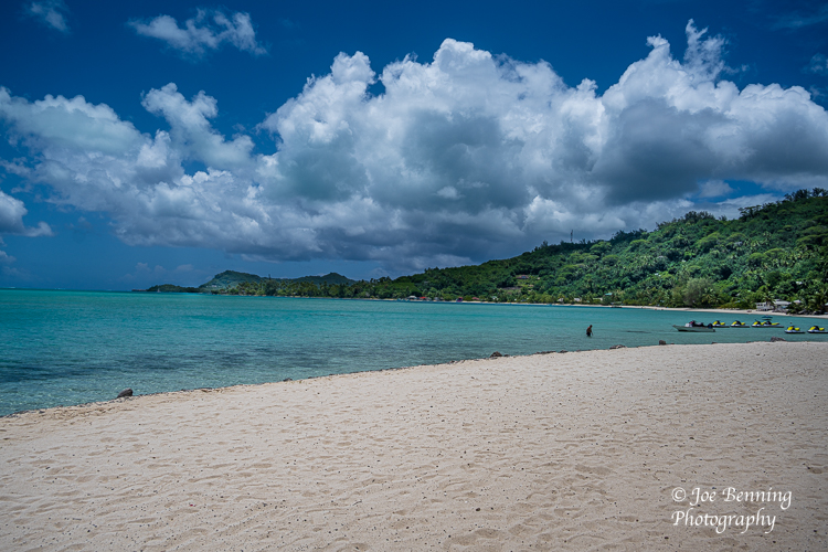
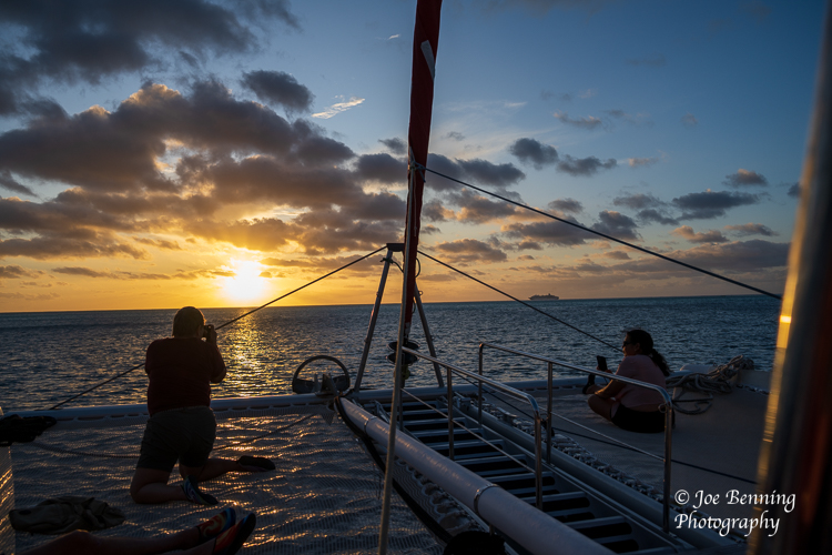
Turquoise Waters of the LagoonPhoto of iconic Bora Bora huts built on wooden posts over the waters of a lagoon.Photo of a landing pier where tender ships dock at Bora BoraA wide angle photo of a public beach in Bora Bora French PolynesiaA photo of the silhouette of a tourist taking a photo of a Bora Bora sunset from a CatamarinSunset Sail on Bora Bora